23–24 January 2027 · Veliky Novgorod
ЗИМНИЕ ВЫХОДНЫЕ ВЕЛОКРОССА · 3ВВ
Два дня ТИПАЦИКЛОКРОССА: Cyclocross, Gravel, Fixed gear, МТБ и беговой кросс. Один день или оба.
23–24 January 2027 · Veliky Novgorod
Два дня ТИПАЦИКЛОКРОССА: Cyclocross, Gravel, Fixed gear, МТБ и беговой кросс. Один день или оба.
19 June 2027 · Batetsky
Tsar Grader 202725 October — 7 November 2026 · XCnews
INOCROSSApril 10-11, 2027 · Veliky Novgorod
Spring Cyclocross WeekendFrom 22 November 2026 · Saint Petersburg and the Leningrad Region
WINTER CUP XCNEWS499 ₽ / month · Для гонщиков
FATRACING PREMIUMОт 2 999 ₽ / month · For business
FATRACING PRORide along the coast, climb to Alanya Castle or head inland into the mountains. This guide brings together four open tracks from Team Tassabu and 29 route links published by Avena and Sunpark. Choose the kind of ride first, then check its actual line and starting point: Alanya, Oba and Mahmutlar are different bases.
Along the sea: start with Mahmutlar–Alanya, the flattest of our four tracks. Low climbing does not mean a cycle path free of traffic and pedestrians.
The castle: a similar coastal ride from Mahmutlar with a climb at the end, combining sea views with a short uphill effort.
Dim Cave: a shorter track heading inland. Dim Cave / Dim Mağarası is a different destination from the Dimçayı valley or a loop around the reservoir.
A mountain day: the archived To the Top track climbs above 1,100 m. At roughly 36 km it is far from a recovery spin. For more options, look for Dereköy, Güzelbağ and Gündoğmuş in the collections below.
These GPX files come from a Team Tassabu page dated 2013 and were downloaded and checked on October 31, 2026. They are archived geometry, not a recent road report. All four start around Mahmutlar; the ride from your accommodation is extra.
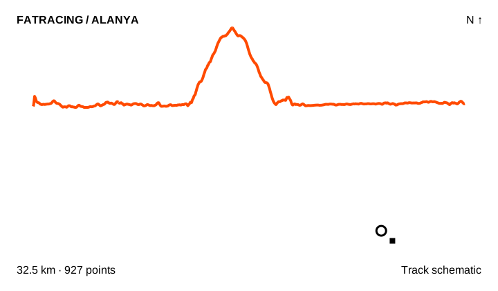
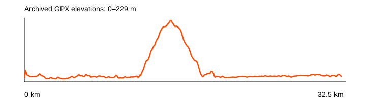
A coastal ride with a climb to the castle. Its distance includes the approach from Mahmutlar; an Alanya town-centre start will differ.
Source elevation gain: 280 m · GPX elevations: 0–229 m. 6 segments; largest gap: 22 m.
Map tiles are unavailable. The schematic and GPX are still accessible.
Source: Team Tassabu · 2013 · Original ZIP
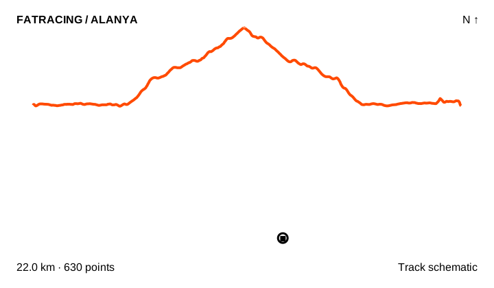
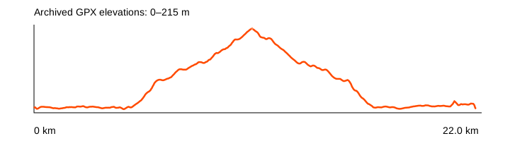
A ride towards Dim Cave, rather than a reservoir loop or a valley-only ride. Check the destination on the map.
Source elevation gain: 302 m · GPX elevations: 0–215 m. 11 segments; largest gap: 39 m.
Map tiles are unavailable. The schematic and GPX are still accessible.
Source: Team Tassabu · 2013 · Original ZIP
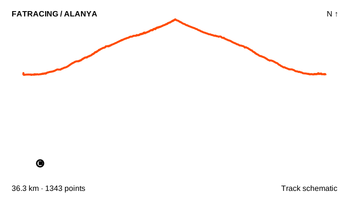
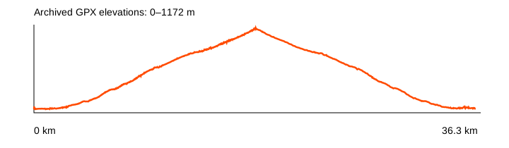
An archived track reaching about 1,172 m. The source calls it To the Top; the specific summit name has not been confirmed.
Source elevation gain: 1844 m · GPX elevations: 0–1172 m. 1 segments; largest gap: 0 m.
Map tiles are unavailable. The schematic and GPX are still accessible.
Source: Team Tassabu · 2013 · Original ZIP
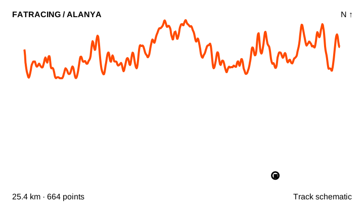
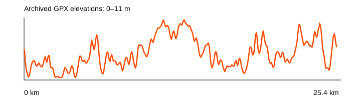
The flattest of these four archived rides. The recorded line does not establish a continuous present-day cycle path.
Source elevation gain: 80 m · GPX elevations: 0–11 m. 4 segments; largest gap: 10 m.
Map tiles are unavailable. The schematic and GPX are still accessible.
Source: Team Tassabu · 2013 · Original ZIP
The Russian-language pages of the two hotel groups list 15 Avena routes and 14 Sunpark routes. Their Strava links required login when checked. We have not obtained their geometry and do not assign distance, climbing or surface claims to them. Routes from different hotels may share roads: 29 links do not mean 29 independent loops.
Start and return. Compare your accommodation with the GPX start. A Mahmutlar track does not start at Cleopatra Beach. Plan an early turn and a shorter return option.
Coastal roads. Check where the line meets D400, junctions, tunnels and crossings. A GPX file does not confirm that every section remains accessible or suitable today.
Surface and bike. Team Tassabu describes all four routes as paved while also labelling them MTB. These are historical labels, not a current surface survey or a promise of suitability for narrow road tyres. Avena and Sunpark group ROAD and MTB together; inspect each route individually.
Mountains. Check the forecast at altitude, water capacity, daylight and brakes before a long climb and descent. Water points, cafés and repair shops have not been verified in this research.
Navigation. Download the GPX and an offline map beforehand. A white circle marks the start and a black square the finish. Expanded previews load OpenStreetMap; the schematic remains available if map tiles fail.
Coordinates, elevations and segment boundaries are preserved; timestamps and device metadata are removed. Distance is recalculated within segments without joining gaps. Three files contain short gaps and isolated GPS points: the schematic does not invent connecting roads. Climbing figures below are source claims; profiles use archived elevations. Neither is a new road or access survey.
Russian-language reports provide context, but do not replace a track and a current conditions check:
Alanya1 contains unit errors and ambiguous elevation labels, so we do not copy its figures into route cards. Mountain Race running trails are not presented as cycling routes. Sapadere, Syedra and other sights are not offered as ready-to-ride tracks without verified geometry.
Upcoming races and useful sections of FATRACING.
Instagram belongs to Meta Platforms Inc., whose activities are recognized as extremist and banned on the territory of the Russian Federation.